2017年11月19日 星期日

Teapot Mountain Hiking Trail in Jinguashi, Taipei

Teapot Mt (茶壺山) hiking trail is also a famous trail in the Jiufen/Jinguashi area. You won't regret to hike here. The top of the mountain is a rock named the Teapot.

Before the Teapot

The Bus 1062 line is operated for foreigners. You can take the bus at Zhongxiao Fuxing MRT station in the center of Taipei city. About one hour later, the bus will stop at Jiufen, Jinguashi (Gold museum) and Jinguashi ( Quanji Temple). The Teapot Mt hiking trail head is just near Quanji Temple. In Taiwan, there is no fee for any temple or toilet.

There is a small mountain named Baoshi Mt near the temple; it takes 5 mins to the viewpoint where you can see the typical northern coastal scenery of Taiwan. Then,  I recommend you to walk through the Baoshi Tunnel under the Mt. which was a Japanese military facility in World War II. 

On the trail to the Baoshi viewpoint
View of Baoshi viewpoint
The Baoshi Tunnel

Teapot Mt trail head

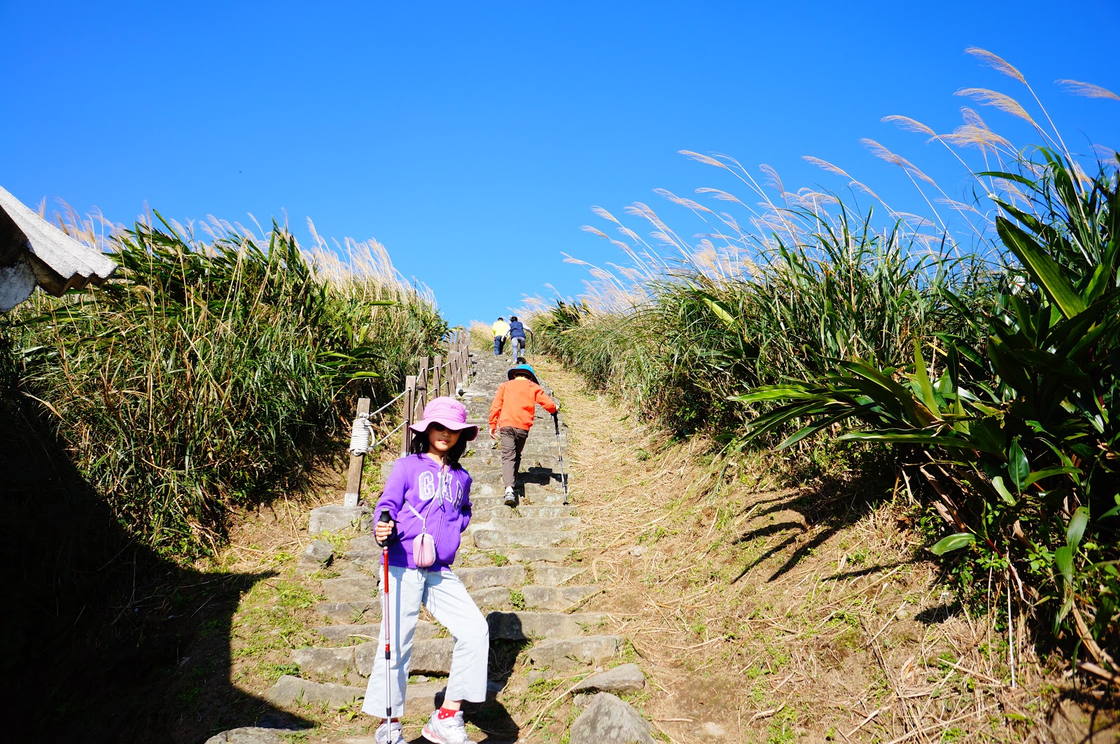
The landscape of the mountain is full of silvergrass because of perennial strong wind from the north. You may meet a tree which is shaped by the wind. The entrance of the trail is about 260 m elevation above the sea, and the Teapot is 600m elevation. The trail is steep with thousands of stairs,and the trail crosses The Romantic Road several times. The Romantic Road twists upon the mountain from Quanji temple to the Teapot; you can  hire a taxi to have a scenic drive if you want. There are many taxi drivers at Jiufen and Jinguashi (Gold museum) bus stops, and they are very happy to do so.

A tree shaped by the wind
The Romantic Road
Season of silvergrass blooming

Yin Yang Sea, the yellow part of the blue sea water

There is a yellow part in the coastal blue sea water due to the metal-rich river. We call it Yin-Yang sea. Yin and Yang  are important concepts in Asian culture,  representing sun and moon, male and female, brightness and darkness, Good and evil. The Mix of Yin And Yang is Taichi, which is in the center of the Korean flag.

The view on the trail is awesome, You can see the best view on sunny days, and don't forget to bring enough water and wear a hat. The Teapot is a rock and you can climb up by the rope. There's still a trail leading to the Banping and Cangualiao Mt. Do not go beyond the Teapot unless  accompanied with a guide; there are cliffs. You may think that the rock doesn't look like a teapot, because it looks like a teapot only from the direction of Jinguashi. 

View on the trail


View of Keelung Mt.
The Teapot's surface is rusting

We are going down now

It may take you 1.5 hr to go up and 1 hr to go down. There are several family-owned restaurants near the Quanji temple. I recommend you to try a bowl of hot Baiyumifen (白魚米粉) , rice noodles with fried hairtail fish.

Accommodations are available in Jiufen and Jinguashi. If you have time, stay for one night would be a wonderful experience. 


Warning: Stay on the trail is mandatory. This is a gold mountain, and there are a lot of pits. In recent years, two men died because of falling into a pit outside the trail.

Quanji Temple

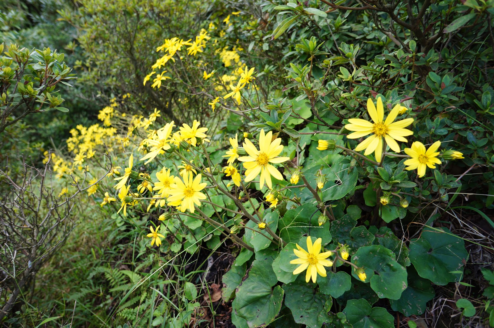
Farfugium japonicum var. formosanum (Hayata) Kitam. The yellow flower is frequently seen on the northern Taiwan hiking trail in Oct and Nov. 

The Golden fall, a viewpoint near Jinguashi

Simple info:

The Teapot , elev 600m 
The trail head, elev 260m
1.5 hr to go up, 1 hr to go down
Must stay on the trail

Bus 1062 , from Zhongxiao Fuxing MRT station to Jinguashi ( Quanji Temple)

The nearby Keelung Mt hiking trail


2017年11月16日 星期四

Xiangshan Trail in Taipei

Xiangshan (象山) trail is probably the most popular trail in Taipei for foreigners. On the trail, you can see the best view of Taipei101.


Xiangshan means Elephant mountain. There are 3 other mountains nearby : Hushan (Tiger), Shishan (Lion), Baoshan (Leopard). The four mountains can be called Sishaoshan ( The Four Beasts).

Xiang (象) is also probably the most famous Chinese character. Elephants existed in ancient China, but extincted thousands years ago. The ancestors told the offspring the image of elephants by drawing the shape of an elephant. The drawing then became a word. Pictograph is now called elephant-shape characters in Chinese (象形文字).

The ancient and current Chinese word of the elephant; that is so called Pictograph.  These words emphasize the long nose and big eyes of an elephant. The word also has 4 legs and 1 tail. 

OK, let's go to the trail now.


The entrance of Xiangshan trail is just 700 meters away from the Xiangshan MRT station. Take the No 2 exit and follow the road signs, and you will find the entrance. The trail is always full of visitors.

The initial part of the the trail is steep with hundreds of steps, and it may take you 20 minutes to finish it. When you reach the 6 Rocks, the trail become much easier to walk. There are several viewpoints on the trail, where are always full of photographers with their tripods.

Sunset is the best visiting time, thus you can see the dynamic views of Taipei city. There are lamps along the trail, therefore walking at night is OK, too. At daytime you can go to other Beasts, but don't go at night.

The visitors on the 6 rocks waiting for sunset


( These photos were taken by my mobile phone without a tripod )

You visited Taipei, but you didn't go to the Xiangshan trail and take a beautiful Taipei101 picture; it would be a pity.


Simple info:

No 2 exit of Xiangshan MRT station
Follow road signs to the trail entrance (700m)
20 mins steps to the Viewpoints.
Bring your best camera.


2017年11月14日 星期二

Keelung mountain hiking trail in Jiufen


Jiufen (九份) is a very popular place now,  and many foreign visitors go there to enjoy the special style of the old town. Jiufen means 9 things, because there were only 9 family lived in this mountainous area before gold mine was found. If someone went to the town to buy something, he would buy 9 things at the same time.

Keelung mountain is just in front of Jiufen, but many visitors missed the nearby hiking trail. The entrance of the hiking trail is near the parking lot of Jiufen, and is 150 m away from the entrance of Jiufen old street.

Keelung Mt

The trail entrance on the main road.

There are several lookout points on the trail, and you can see the full view of Jiufen and Jingaushi(金瓜石). Because of annual strong wind from the north, the mountains are usually covered with silvergrass, and it wound be very hot on the trail under the sun. Wearing a hat is needed for the sun and wind.

Soon after hiking, two roads will diverge in the silvergrass, and you can choose any one to travel, because the two roads will meet together again.  The main trail (685 m) is steep with thousand of steps, and the branch one (1395 m)  is less steep but longer. It may take you 40 mins to go up and 30 mins to go down. It is rather easy to finish the trail and you can see the gorgeous view of both the mountains and the sea. I recommend you to eat a bowl of sliced ice in Jiufen after hiking, and that wound be a wonderful experience.

The main trail and the branch. 
Steep main trail

My kids walking on the steep main trail. 

The view on the trail 

The view on the trail

The view of Jinguashi and Jiufen

Beatiful silvergrass

Mountain climbing may change history.  These mountains near Jiufen, including the Keelung island,  were formed about 1 millions years ago by undersea volcanic eruption, therefore some metals, such as gold , silver and copper were brought to the earth surface.

In 1626-1642, the Spanish people built a castle in Keelung, but they were defeated by the Dutch. The Dutch in southern Taiwan were then defeated by Koxinga in 1662. The Dutch occupied Keelung again in 1664, but they leaved Keelung in 1667 because they found nothing good here. Because they did not climb these mountains , they didn't find the gold. The gold mine was found in 1890, and it was once the biggest gold mine in Asia. There is still gold in the deep of Jiufen and Jinguashi.

The whole view of Keelung Mt.  I took this picture on the top of Teapot Mt near Jinguashi. 


Simple info:

Keelung Mt peak (elev 558 m)
Entrance (elev 328 m) , near Jiufen parking lot, 150m away form the entrance of Jiufen old street.
Main trail (658 m)
Branch trail (1395 m)
40 mins go up , 30 mins go down


2017年11月13日 星期一

Qixing Mountain Trails in Taipei

Qixing mountain(七星山) is located in the center of Yangmingshan (陽明山) National Park (YMS NP). It is the highest mountain (elevation 1120m) in Taipei City. Qixing Mt can be also spelled as Chihsing or called as Seven stars Mt. 

The main peak of Qixing Mt.

There are not only skyscrapers and fine food in Taipei. If you have a whole day' time in Taipei, and the weather is good, climbing the mountain wound be a wonderful experience for you.

There are three trails to the Mountain top, which are from the Miaopu(苗圃) , Xiaoyoukeng(小油坑), and Lengshukeng(冷水坑) entrances.


There are parking lots near the 3 entrances. Otherwise, you may take the  Bus 260 from the Jiantan MRT station to the Yangmingshan Terminal Station,  and then take the  Bus 108 which goes around the YMS NP in a clockwise direction, and it will stop at the 3 entrances. The Taipei bus cooperation adjusts the transportation according to the weather conditions. The Bus S15 runs between Lengshukeng and Jiantan MRT station, and it is also a good choice of visiting the mountain.

The Miaopu trail entrance (elevation 570m) is the nearest one from Taipei city, but It is the  toughest one. The Xiaoyoukeng trail (elevation 811 m)  is the easiest one,and you can enjoy the gorgeous volcanic view at the same time.  You can feel the hot air came out from the fumarole ,and smell the unpleasant odor of sulfur compounds from the deep of the Earth. Although the volcano is still active, but don't worry, the last eruption was just 200 thousand years ago.  Menghuan pond  (夢幻湖) which is famous for its underwater plants is near the entrance of Lengshukeng (elevation 750). If you have enough time, you can walk to Qingtiangang (擎天崗) from Lengshukeng (1.7km, 50mins). Qingtiangang is the biggest meadow in northern Taiwan, and the meadow was formed after wildfires.

The entrance of Miaopu trail
The forest part of Miaopu trail

The entrance of Xiaoyoukeng
The fumarole on the Xiaoyoukeng trail
Menghuan pond


The trail in the arrow bamboo. 

It may take 2 hours for the Miaopu trail and 1.5 hours for the Xiaoyoukeng trail (just oneway up). And you can choose anyway up or down. Toilets and drinking water are available at the visitor centers near each trail entrance. There's only one toilet in Qixing park on the trail.

The view of Xiaoyoukeng from the Qixing main peak

The view of the east peak of the Qixing Mt from the main peak


I am on the top of Taipei city.

The top and the northern side of the Qixing Mt is covered with silvergrass (芒草) and arrow bamboo(箭竹), and the special landscape is due to perennial strong wind from the north. Besides it is cooler, autumn is the best season of visiting the mountain because of blooming of silvergrass.

You may see many animals on the trail, such as butterflies and lizards. The chestnut tiger butterflies (青斑蝶) have brilliant wings to warm the predators "poisonous",  and they will not fly away when you close up to them. (They think you are scared, too.) The blue-trailed skink (麗紋石龍子) is famous for its bling-bling tail, and it is a frequently-encountered sunbather on the trail. If you are lucky enough, you may meet a family of bamboo partridges(竹雞). In the forest of Miaopu trail, squirrels and birds are seen commonly, and they also make noises.

The chestnut tiger 

The blue-tailed skink 

The bamboo partridge

On the top of the mountain, you can see the best view of Taipei. There are numerous buildings in the Taipei basin and Taipei101 would be easily recognized among them. Several rivers wind through the basin. You can see the ocean of the northern Taiwan island. The mountain top of Daba (大霸尖山) may be visible, if the weather is so good. A poet said that Taipei basin is like a cello, but I think it's more like a cradle which raises up 6 millions of people at daytime and makes them sleep well at night.

The rivers wind through the Taipei basin.


The weather may change quickly in the high mountain area, therefore be sure to have a raincoat with you.  It is always windy on the mountain top , and do not stay there when thundering. Bringing enough water with you is strongly recommended, since it may be hot under the sun. Luckily, cellular phone is OK at most area of the trails.

Road sings every 200 m on the trail. 


Simple info :

Qixing Mt main peak, elev 1120m.
Miaopu , elev 570 m, 2.5km, 2 hr
Xiaoyoukeng,elev 811m, 1.5 km, 1hr 20min
Lengshukeng,elev 750m, 2km, 1hr 40min

Bus 260 from Jiantan to YMS terminal, then Bus 108  to the 3 entrances.
The bus stop near Miaopu entrance is "Second parking lot/Visitor Center".
Bus 108 Range Car runs between YMS terminal and Erzihping (bidirectional), which pass Second parking lot only. 
Bus S15 runs between Jiantan and Lengshukeng.